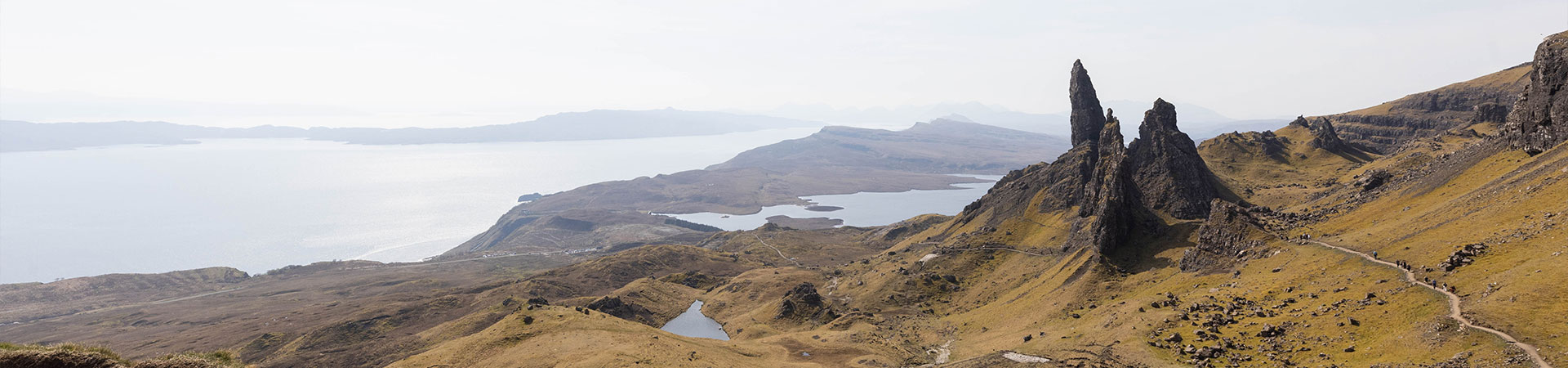
With some of the world’s most beautiful landscapes, walking through the Scottish Isles offers no shortage of adventure.
You’ll pass some of the world’s best whisky distilleries, the UK’s prettiest towns, and discover the best of Scotland’s wildlife. Plus, discover the Gaelic traditions, local crafts, and food that make these islands one-of-a-kind destinations.
Whether you’re taking on a challenging multi-day route while island-hopping, or simply looking for a short stroll to tie in with a visit to one of Scotland’s best beaches, these routes and the scenery they behold are sure to leave you speechless (if not a little breathless).
Kiloran Bay and Carnon Eoin, Colonsay
Best for: Gorgeous beach and scenery
Distance: 2.6 miles
Time: 2 hours
Difficulty: Easy to moderate
Starts/ends: Picnic area at southwest end of the beach
Parking: Kiloran Bay car park
Landmarks: Kiloran Bay and Carnan Eoin
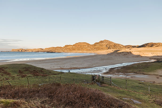
The Isle of Colonsay is known for its white sandy beaches and glorious clifftop walks, with this route taking you onto Kiloran Bay, one of the best beaches in Scotland.
Start at the Kiloran beach car park, where you’ll see Carnon Eoin on the other side of the bay. Pass through the gate and walk across the length of the beach to the other side, marvelling at the pristine sand as you go.
Once you reach the far end, climb the stile and turn right to follow the fenced pathway until you reach a concrete path. Turn left to follow this track and begin the climb until you can take a right onto a smaller path, which follows the direction of the telegraph poles.
Soon, you’ll reach a gap in the hills, where you take a sharp right to follow the path up towards Carnon Eoin. From this point onwards, there are stunning views reaching far across the bay.
To return, retrace the way you came, and for more ideas on what to do while in the area, check out our guide to Colonsay.
Reuval to Rossinish, Benbecula
Best for: Historical immersion
Distance: 8 miles
Time: 4-5 hours
Difficulty: Moderate
Starts/ends: Rueval Footpath car park
Parking: Rueval Footpath car park
Landmarks: Loch Ba Una, Rueval, old blackhouses, and Rossinish Peninsula
For history buffs, the Isle of Benbecula provides an opportunity to follow in the footsteps of Bonnie Prince Charlie as you walk the route he took to escape via boat to Skye in 1746.
Start at the parking area of the waste transfer station on the A865 where you’ll find a sign for the Reuval walking trail. Follow the path until you are south of Reuval, Benbecula’s tallest hill. Climbing it from this side avoids boggy patches and rewards you with views over dozens of lochs, creating a magnificent patchwork of blue across the land below.
Descending the eastern slopes of Reuval, rejoin the path (which becomes pretty small in some places) through sheep’s fields and along a low cliff, while enjoying further spectacular views towards North Uist.
When you reach Rossinish Headland, a flat grassy, open space with a white-sand beach, you’ll need wellies or waterproof shoes to reach the Bonnie Prince’s departure point. Then, turn around and retrace your steps back to the car park.
For more inspiration on what to do while on the isle, read our guide to Benbecula.
Old Man of Storr, Skye

Best for: Dramatic landscapes
Distance: 3 miles
Time: 2 hours
Difficulty: Moderate
Starts/ends: Storr car park
Parking: Storr car park
Landmarks: Old Man of Storr and views of Isle of Raasay and Applecross
One of the most dramatic landmarks in Scotland, Old Man of Storr is on everyone’s Skye bucket list - it’s best to head there early if you want to beat the crowds in peak season.
Head through the gate at the back of the car park, following the wide path uphill. Almost immediately, you’ll be rewarded with stunning views behind you towards the Isle of Raasay and Applecross on the Scottish mainland.
Continue through two gates and the ancient jagged rock pillars of the Storr will come into clear view. Continue following the path left to the Old Man, an isolated piercing rock, and follow the trail around the back for the best viewpoint.
Coming back, you’ll have jaw-dropping, far-reaching views over Loch Leathan, Bearreraig Bay, and the surrounding isles.
Fairy Pools, Skye
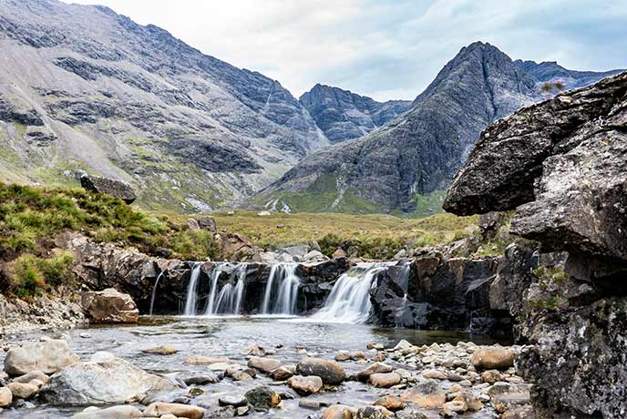
Best for: Waterfalls and mountains
Distance: 1.5 miles
Time: 1-1.5 hours
Difficulty: Easy to moderate
Starts/ends: Fairy pools car park
Parking: Fairy pools car park
Landmarks: Views of the Black Cuillins and various fairy pools
Discover enchanting fairy pools with cascading waterfalls at this mythical site, which legend tells is the boundary between the human and faerie realm. To top things off, this is also one of the most scenic places possible to go for a swim, with grass-covered mountains towering above the crystalline waters.
Leave your vehicle at the Glenbrittle (paid) car park and follow the gravel path to cross two footbridges. From here, there is a steep rocky section that takes you to the first waterfall. This first waterfall is the largest and deepest and marks the start of the fairy pools that wend their way up the river.
Keep following the river upwards, exploring the pools as you go. Remember to take swimwear with you, or even a wetsuit - as the waters are cold! To reach the car park, follow the same route back.
The Three Distilleries Walk, Islay

Best for: Sampling Scottish whisky
Distance: 3 miles
Time: 2 hours (or however long you want to spend at each distillery!)
Difficulty: Easy
Starts/ends: Port Ellen Primary School
Parking: Centre of the village
Landmarks: Port Ellen, MacDougall monument, Portintruan Distillery, Laphroaig Distillery, Lagavulin Distillery and Ardbeg Distillery
What better way to discover Islay’s whisky distilleries than while walking the beautiful island pathways? Islay is known for its peat-rich whiskies, and there are now four distilleries along the route. All offer tours, which are best booked in advance.
Starting in Port Ellen, make your way along the seafront and follow the main road past the Co-op to take a left up the A846 towards Ardbeg. The Distilleries path starts just after the school, leading you within a few minutes to the Portintruan Distillery.
Leaving this first distillery, the route offers beautiful coastal views out to sea, before leading you partway through the woods to the lane of the famous Laphroaig Distillery.
Next, the walk takes you through the remainder of the woods until you’re back on the main road. From here, it’s just over half a mile to Lagavulin Distillery, one of the oldest on the island.
For the final stretch, continue along the road until the path reappears on your right, then crosses back to the left, where you can clearly see the rest of the way to Ardbeg Distillery.
Depending on how much you like the local whisky, opt to walk back the way you came, or you can hop on a bus back to Port Ellen from near Ardbeg.
Laggan Sands and Moy Castle, Mull
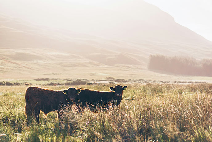
Best for: Highland cows
Distance: 3 miles
Time: 2 hours
Difficulty: Easy
Starts/ends: Lochbuie
Parking: Near the Edward VII memorial
Landmarks: Lochbuie Standing Stones, Moy Castle, St Kilda's Church and Laggan Sands
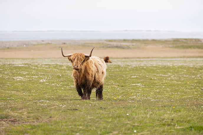
Shaggy Highland cows (or ‘hairy coos’ as the islanders call them) are frequently seen roaming the roadsides, fields, and beaches of the Isle of Mull. This mostly flat coastal route takes you through some of the island's best scenery to a beach where these beloved cattle frequently graze.
Park near the Edward VII memorial monument on the public road in Lochbuie. Head east (facing the sea, turn left) and follow the track past St Kilda’s church.
Enjoy stunning ocean views until you reach a gate, then follow the path that leads along the coastline and brings Moy Castle into view. You’ll also see Lochbuie House, built by Clan MacLaine in 1752 to replace the castle as the chief’s residence.
Continue along the path and keep left, following the signs to Laggan Sands. Here, a broad expanse of silvery sand will greet you along with, oftentimes, a herd of Highland cows.
From here, head back the way you came. Alternatively, you can continue onwards for a longer route, which follows the path to Clan MacLaine chapel and then detours to a standing stone circle.
Machrie Moor Standing Stones, Arran
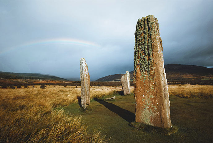
Best for: Prehistoric stones
Distance: 2.75 miles
Time: 1.5 hours
Difficulty: Easy
Starts/ends: Machrie Moor car park
Parking: Machrie Moor car park
Landmarks: Ancient burial cairns, various stone circles and standing stones
Uncover several mystical sets of stone circles while enjoying an easy walk through Arran’s moorland. Dating from 3,500 to 1,500BC, some of the stones are over 5 metres tall, making for truly impressive landmarks.
Start at the Machrie Moor standing stones car park, heading through the gate to follow a level farm track. Soon, you’ll reach an information board, and the first cairn becomes visible on your right. The next landmark is Fingal's Cauldron Seat, two rings of granite blocks, named after Fingal the giant (a figure from Scottish mythology).
Make your way across the grass to the next set of information boards next to a gate. As you pass through the gate, you’ll see another stone circle on the right, while the path on the left leads to a solitary large stone.
The main path leads you to the tallest set of stones on the route, a group of three huge slabs, backed by rolling moorland and mountains in the distance. Enjoy the scenery and the mystery of the place before heading back to the car park.
The Hebridean Way

Best for: Long multi-day trek
Distance: 156 miles
Time: 12 days
Difficulty: Hard
Starts/ends: Vatersay/Lews Castle
Landmarks: Kisimul Castle, Luskentyre Sands, Calanais Standing Stones, Lews Castle and many more
For the ultimate multi-day hiking adventure, the Hebridean Way traces 156 miles of pathways through a series of islands belonging to Argyll & Bute.
You’ll discover 10 islands, starting in Vatersay and hiking north to the finish in Lewis, passing along dramatic Atlantic coastlines, through untouched scenery, and discovering the region’s unique Gaelic heritage.
There’s a good chance of spotting Scotland’s ‘big five’ wildlife species along the journey and on inter-island ferries. Opt to complete it in sections across multiple stays, or take on the whole hike as part of an epic 12-day adventure.
Feeling inspired? Plan your visit to the Scottish Isles and stay in one of our gorgeous Scottish holiday cottages for the chance to discover some of the UK’s best hiking.