Britain is fantastic for walking. An incredible diversity of landscapes means it’s possible to climb a rugged mountain peak and stroll across a sandy beach in the same walk. We have ancient woodland, meandering rivers, wildflower meadows, moorland, mountain ranges, and miles and miles of coastline to explore, all within relatively easy reach, wherever you are in the country.
Having spent the best part of a decade researching and writing walking routes, it was a challenge to pick just five of our favourites. A bit like a job interview, we shortlisted them based on essential and desirable criteria, then whittled them down to the chosen few. The result is a set of walks that – we think – tick all the boxes: exciting terrain, superb views, awe-inspiring geology, wonderful wildlife and, of course, a café at the finish for the all-important post-walk refreshments.
Jen and Sim Benson are outdoor writers with a passion for wild places. They’ve written 15 books on walking, running, and adventures with kids and dogs, and have a weekly column – A Good Walk – in The Times. Follow them on Instagram and visit their website to follow along with their journeys.
Meldon, Blackator and High Willhays, Dartmoor National Park, Devon
Best for: Scenic reservoirs, ancient temperate rainforests and Dartmoor’s highest tors
Distance: 12 miles from Okehampton station, 7 miles from Meldon Reservoir car park
Time: 4 – 6 hours
Difficulty: Challenging
Starts/ends: Okehampton train station or Meldon Reservoir car park
Parking: Okehampton train station car park (EX20 1EJ), or Meldon Reservoir car park (EX20 4LU)
Public transport: Trains connect Exeter to Okehampton, or local buses to Okehampton. No public transport to Meldon Reservoir.
Landmarks: Meldon Viaduct, Meldon Reservoir, Black-a-Tor Copse, High Willhays, Yes Tor
Refreshments: The Bulleid Buffet, Okehampton station
Okehampton station reopened to passengers in 2021 after an absence of nearly 40 years. Arriving at the pretty, green-painted station with its lovely independent café is an ideal start to a walk on Dartmoor, with waymarked trails starting from the door.
This walk to discover Dartmoor’s highest tors follows the Two Castles Way from the station, passing the ruins of Okehampton Castle to reach Meldon Reservoir. Cross the vertiginous dam, which rises 55 metres (180ft) from the glacier-carved depths of Meldon Gorge, with beautiful views out across the water.
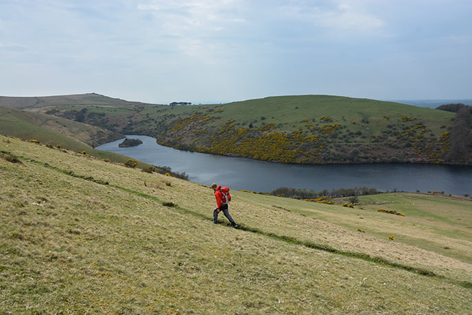
From the southern end of the reservoir, the tree-fringed valley of the West Okement River leads up to Black-a-Tor Copse. Take a moment to admire this rare and ancient high-altitude oak woodland, a fragment of temperate rainforest rich in mosses, lichens, and rare invertebrates.
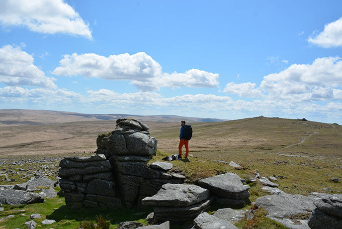
The gradient steepens on the approach to High Willhays, Dartmoor’s highest point at 621m (2,039ft). The tors that shape Dartmoor’s distinctive skyline are knuckles of granite exposed by weathering, part of a vast, underground igneous mass, the Cornubian batholith, which extends southwest through Cornwall and the Isles of Scilly.
At the top, the rocky stacks of High Willhays and Yes Tor stand on a sprawling summit. The views are spectacular on a clear day, from North Devon’s mosaic of woods and fields to the vast, rolling expanses of the moor.
It’s a straightforward, almost-straight line back to Meldon, with a long but enjoyable descent across rough, pony-grazed grassland, the distant glimmer of the reservoir in the valley below. Finish with an easy amble through the woods back to Okehampton station.
Rydal Water and Loughrigg Fell, Lake District National Park, Cumbria
Best for: Exceptional views, mining heritage, swimming lakes and an achievable summit
Distance: 6.5 miles
Time: 4 hours
Difficulty: Moderate
Starts/ends: White Moss car park
Parking: White Moss car park, off the A591, LA22 9SE
Public transport: Several buses follow the A591 from Windermere station towards Grasmere and Keswick, alight at Rydal.
Landmarks: Rydal Water, Rydal Caves, Loughrigg Tarn, Loughrigg Fell summit, Grasmere
Refreshments: The Jumble Room, Grasmere
Rising to just 335m (1,099ft), Loughrigg Fell in Cumbria is one of the most achievable Wainwrights. Despite its diminutive stature, its commanding position makes it one of the best viewpoints in the national park, with grand views of the surrounding lakes, the Old Man of Coniston, the jagged summits of the Langdale Pikes and beyond to Scafell Pike, the roof of England.
This walk starts along the River Rothay, which links the lakes of Grasmere and Rydal. This first mile or so is perfect for younger children, with surfaced, buggy-friendly paths, interesting woodland, and shallow shingle beaches for paddling, frequented by ducks, dippers, and herons.
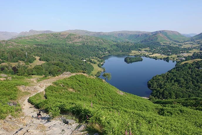
Emerging from the woods, the path climbs above Rydal Water to reach the yawning jaws of Rydal Caves. A former slate quarry, the intrepid can venture in across the stepping stones. Otherwise, continue up the rising valley to the shoulder between Tod Crag and Ivy Crag and over to Loughrigg Tarn. With its mountain backdrop, this tiny lake is an idyllic picnicking and wild swimming spot.
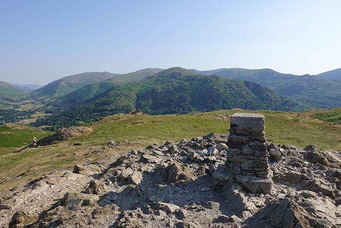
The climb from the tarn to the summit of Loughrigg Fell is steep but well worth it for the views. Then it’s all downhill to finish, zigzagging across Loughrigg Terrace to reach the shores of Grasmere. Retrace your steps through the woods to the car park, or take the longer route that circumnavigates the lake via lunch in Grasmere village - gingerbread, anyone?
Brancaster, Norfolk
Best for: Coast paths, sandy beaches, birdwatching and Roman forts
Distance: 5.5 miles
Time: 2.5 hours
Difficulty: Easy
Starts/ends: Brancaster Village Store and Café, PE31 8AA
Parking: Use Brancaster Beach car park, PE31 8AX
Public transport: Trains to King’s Lynn, regular coastal buses to Brancaster.
Landmarks: Brancaster Marsh, Barrow Common, Branodunum Roman Fort
Refreshments: The Ship, Brancaster
Sheltered from the North Sea by Scolt Head Island, Brancaster’s reclaimed saltmarsh is a haven for wildlife, particularly the vast numbers of birds that live and migrate here throughout the year. Look out for black-tailed godwits, Eurasian spoonbills, marsh harriers and egrets, and, over the winter months, vast flocks of pink-footed and brent geese.
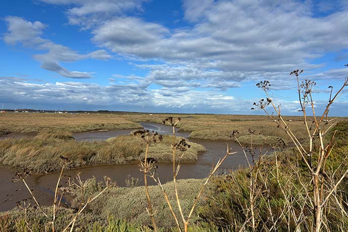
From Brancaster village, head for the sea, following the Norfolk coast path along a 2-mile stretch of boardwalk at the edge of the marshes. At Burnham Deepdale, turn inland, following quiet lanes through woods and countryside to Barrow Common, a swathe of heathland visited by turtle doves in summer. The relative height of the common affords great views over Brancaster to Scolt Head National Nature Reserve and the wreck of the SS Vina, sunk during practice in the Second World War.
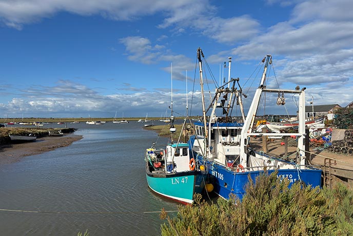
Descending back towards the coast brings you to Branodunum, a Roman fort built around 230 AD against Saxon invasion. One of eleven Saxon Shore Forts dotted around England’s south-east coast, it was used for 150 years until the Romans withdrew from Britain.
Coire Lagan, Isle of Skye
Best for: Remote sandy beaches, mountain lakes, and waterfalls
Distance: 5.5 miles
Time: 3.5 hours
Difficulty: Moderate, with an avoidable challenging section
Starts/ends: Glenbrittle car park or campsite
Parking: Glenbrittle car park or campsite, IV47 8TA
Public transport: Trains to Kyle of Lochalsh, then buses to Sligachan, but no transport from there
Landmarks: Loch Brittle Beach, the Black Cuillin, Coire Lagan, Eas Mòr waterfall
Refreshments: Glenbrittle Café
The Isle of Skye is the largest of the Inner Hebrides, measuring 50 miles north to south. The island’s rugged landscape is dominated by two mountain ranges: the Black Cuillin and the Red Cuillin, separated by the spectacular, glacially-carved valley of Glen Sligachan. The Black Cuillin, formed from 60-million-year-old igneous rock, is the more challenging of the two when it comes to walking - the famous traverse of the mighty ridge is among the hardest mountain walks in the UK, ticking off 11 Munros and 16 other summits along its 8-mile length.
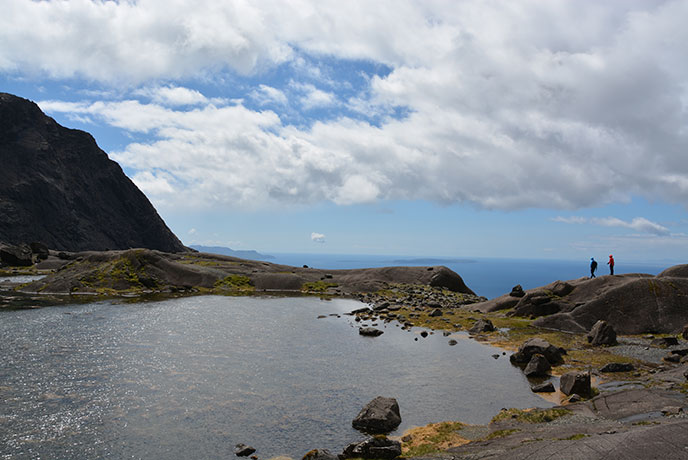
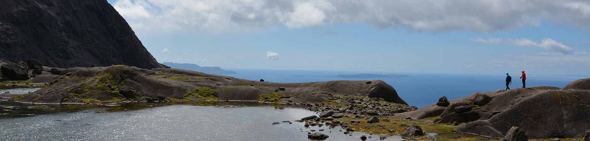
The miniature valley of Coire Lagan nestles at the heart of a dramatic natural amphitheatre in the Black Cuillin. Set deep within the coire, a shimmering lochan reflects the vast skies and encircling jagged peaks - it’s hard to imagine a more spectacular setting.
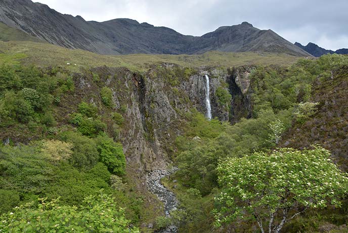
This walk follows the clear path up to Coire Lagan from the sandy beach at the northern end of Loch Brittle. Glorious views out over the loch to the neighbouring islands of Rhum and Eigg open up as you gradually gain height. At the junction below the coire, the sure-footed can scramble up the final section (it’s steep but not difficult) to visit the lochan, a truly magical sight. The route returns past the serene waters of the larger Loch an Fhir-bhallaich, joining the course of the Allt Coire na Banachdich River, which flows over the delightful Eas Mor waterfalls and on down to Glenbrittle.
Cwm Bychan and the Pass of Aberglaslyn, Beddgelert, Eryri National Park
Best for: Glacial llyns, mountain passes, and rocky river gorges
Distance: 5.5 miles
Time: 3 hours
Difficulty: Moderate to challenging
Starts/ends: Beddgelert town bridge
Parking: 7 Cae Morys car park, Beddgelert, LL55 4YW
Public transport: Trains to Bangor or Porthmadog, buses to Beddgelert
Landmarks: Llyn Dinas, Cwm Bychan, Pass of Aberglaslyn
Refreshments: Bistro Hebog, Beddgelert
Set at the confluence of two fast-flowing rivers - the Glaslyn and the Colwyn - the pretty village of Beddgelert is an ideal base for exploring Eryri (Snowdonia) in Wales. Within easy reach are Moel Hebog to the west; the Yr Wyddfa (Snowdon) range directly north; and Cnicht - the Welsh Matterhorn -- to the east.
Starting from Beddgelert bridge, this walk traces the course of the Glaslyn River, with views to Moel Siabod, the highest of the Moelwynion range. Look out for Sygun Copper Mine, where copper has been extracted from 500-million-year-old rocks since the Bronze Age, with excavations forming a gradually deepening network of tunnels and caves.
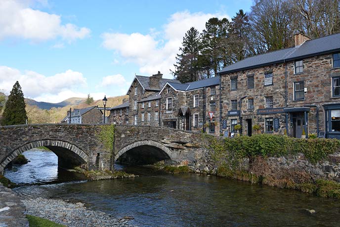
At the lane’s end, the Glaslyn flows into Llyn Dinas, home to Carreg yr Eryr, the stone of the eagle, a 12th-century marker of the meeting point between the three cantrefs of Aberconwy, Ardudwy, and Arfon, and a red dragon, which, legend has it, lurks beneath the water. From the lake, a steep, zigzag path climbs to Cwm Bychan, an atmospheric place of former mineworks undergoing reclamation by the wild. The rare heathland here, only found in western coastal areas of Europe, provides habitat for grayling butterflies and birds, including wheatear and whinchat.
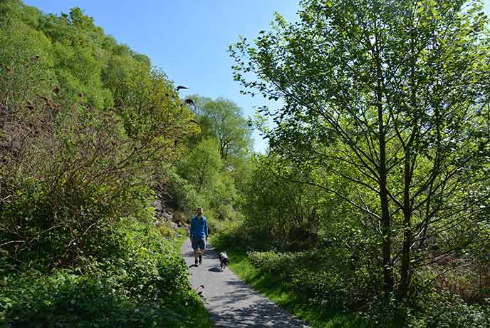
Descending to Nantmor, at the foot of Cwm Bychan, the return to Beddgelert follows the exhilarating Fishermen’s Path, hewn into the rocky side of the Aberglaslyn Gorge. It’s an adventurous undertaking, and best avoided in wet weather, but on a dry day, traversing above the thundering rapids and serene turquoise pools of the Glaslyn, it’s a perfect end to the walk.
Inspired to go on your very own walking adventure? Explore our collection of cottages across the UK and find the perfect place for your next walking holiday.